Muambong is exclusively a farming community comprising about 1000 households and over 5000 inhabitants, with a current per capita income of around US$ 170. It is located in Kupe-Muangenguba Division in the South West Province of Cameroon. Its economy, like that of adjoining areas, depends precariously on coffee farming for 70% of household incomes as well as on subsistence agriculture. The community is linked by rough roads to other agglomerations of the Kupe-Muanenguba Division. Muambong is situated along the Cameroon chain of mountains between Mt Kupe to the south and Mt Muanenguba to the north. One major highland in Muambong, Ahii de Nkang measures a height of approximately 300m. Faults scarps can be seen along water courses e.g Tennerre.
Climate
Muambong is constantly wet for the greater part of the year. The temperature ranges from 16°c in the coolest day to about 21°c on hot days. Temperatures are generally low at night and warm during the day. Rain falls about 8 months every year. The rainy season begins during the month of march. The rains are usually torrential and are accompanied by thunderstorms. Annual averages stand at approximately 3800mm. Almost every month experiences rain.
Hydrology
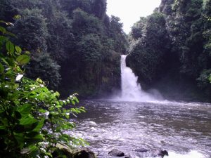
Streams in Muambong area include Tennere, Ehene, Wumelle, Mwandebe and Chunge. All these streams take their rise around the Muanenguba highlands. The streams are mainly used for fishing. The Chungmendibe which takes its rise from Muambong itself supplies this area with pipe Bourne water. Crops are usually planted along the Wumelle during the dry season. Lake Rudolf or Lk Muambong is small and still needs to be developed.
“Mbwandebe” is a small stream that flows all round the year. it has it at “nsii” before you rich the secondary school area. it flows behind muesock and crosses the road between muesock and Banbegung.
Settlement Pattern
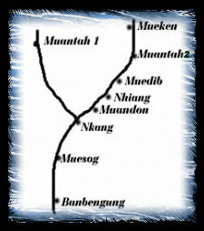 The fact that the area is predominatly covered by forest, the people were formerly dispersed as every family concentrated in a particular area following ancestral line. But with the construction of the Tombel- Bamgem road which passes Muambong, all the villages were invited to take advantage of the road. This has given rise to a linear pattern as all the villages of Muambong are found along the road. With this pattern, the distribution of the community pipe borne water and rural electricity was made easy as almost all villages in the clan are accessible.
Population
Muambong has an estimated population of 5000 people distributed over a surface area of about 16km. This number is not evenly distributed. Some Villages have a high ratio than others. The population is very dynamic and made up of mainly farmers. As in every community, the young dominate the population.
Vegetation
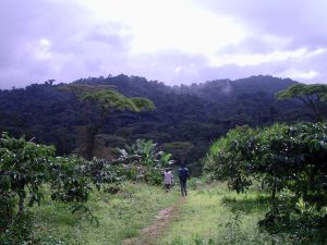
Muambong has the tropical rainforest vegetation. Due to the high temperatures and heavy rainfall all through the year, the soil is constantly moist, which permits the growth of trees. Where the forest is still virgin, tree species common to rainforest areas are found like, iroko, Mahoganny, just to name a few. However, much of these forests are being cut down for farming.